Or: how to bail from a climb and still have a good time.


FIRST ATTEMPT (failed before starting)
I was already living in South Africa when I saw a picture of Mount Kenya for the first time. It was an old black and white picture showing severe, black spires covered in rock and snow. By then I had already been a climber for a decade. That picture aroused my curiosity, making me realise that even in Africa there may be peaks with an alpine flavour to them. The idea of climbing Mt Kenya kept rattling in my head as an elusive, theoretical concept for a couple of years, until a conversation with my friend Evan turned this vague dream into a project. Evan had already tried climbing Mt Kenya a few times, always having to turn back, and was eager to finish the business. I felt as if my many leisurely climbs on perfect South African cliffs in the fair South African weather were making me mellow, and I felt like an adventure, something different from my many tame climbs on perfect South African sandstone. It was 2018 when we started planning our expedition, which was meant to take place early in 2019. In that respect, Evan’s experience was priceless: he told me about the mountain’s “short” and “long” dry seasons (in January/February and around September, respectively), the possible approach routes and the possible climbing routes. Even so, I still had a hard time picturing the mountain: Mt Kenya is a complicated massif of volcanic origin, with jagged ridge systems, spires and secondary peaks that are hard to visualise from the old maps and pixelated black-and-white pictures available in the guidebooks. Up to that point, all I knew about Mt Kenya were basic geographical notions: it is located about 140 km East-North-East of Nairobi and a handful of km South of the Equator; its highest peak, Batian, stands at 5’199 m a.s.l., making Mt Kenya the second tallest mountain in Africa after Kilimanjaro; the mountain’s second-highest peak is Nelion (5’188 m a.s.l.); Batian and Nelion can only be reached via technical climbing routes, while Point Lenana (4’985 m a.s.l.), Mt Kenya’s third highest point, is a popular hiking destination.
We decided to attempt the climb in January, during the short dry season. The best way to the summit at that time of the year seems to be from the Southern side, climbing peak Nelion, then traversing via a col with the dramatic name of Gate of Mists to reach Batian. Planning the details of the expedition and training for it filled all our spare time. In October 2018 Julian Wright and Trystan Firman bagged a rare ascent of the Diamond Couloir, an ice route on the South face of the mountain that has become more and more elusive in recent years due to global warming. Evan and I took their success as a good omen for our own expedition. Unfortunately, it turned out to be far from the truth. January came, Evan was already waiting for me in Kenya, when the news broke of a terrorist attack in Nairobi, at the very hotel where Evan was staying. Evan narrowly avoided being involved in the attack, but at least 21 people died in it and the hotel underwent a lockdown for days.
Evan was shaken by the attack, even if he would not admit it easily; moreover, most of our climbing gear was locked into the hotel and it would take weeks for it to be cleared by the Kenyan bomb disposal units. The entire logistics of our trip went belly up. We had to call the expedition off before it even started.
SECOND ATTEMPT
The next chance of climbing Mt Kenya was to be in September, during the “long” dry season. Evan was caught up with work, so I found myself with the necessary time, drive, and resources, but short of a partner. I decided to take the risk and look for a climbing partner on the internet. Days after I received an enthusiastic email from Vivek, a professor of engineering with extensive experience in Yosemite and the Alps. I resolved to do what my mom would always tell me not to do: trust a stranger from the internet.
This time round I did not have the advantage of a partner that knew the mountain, so I had to take the reins of the logistical plans: we decided to hike up the mountain via the Sirimon route, set our base camp at Shipton’s Camp, acclimatise, move the camp higher, climb up to Batian following the North Face Standard Route, descend via the same route, and walk down via the Chogoria route. We budgeted three days to gain altitude and acclimatise, two days for the climb, two days for the descent, and a couple of extra days to account for bad luck or bad weather.
Vivek offered to organise the food. He had mastered the art of concocting dried-freezed meals with just the right amount of taste and calories, going as far as reproducing traditional recipes such as Indian curries or Cajun gumbo.
In terms of climbing gear, we chose our equipment in the name of “fast and light”. We ditched the traditional half ropes for a single rope, which would facilitate simul-climbing and speed up rope-handling. In order to still be able to do long abseils, as well as having a backup rope in case the main one got damaged, Vivek brought a Edelrid Rap Line II, a hybrid between a dynamic rope and a 6 mm abseil line.
We only resolved to hire a porter after much deliberation: we wanted to get the summit with our own strength and skills as much as we could, which is also why we decided agains hiring a mountain guide. When it came to the porter we had to be realistic and agree that, were we to carry all the gear by ourselves, we would have been spent before even starting the climb. Hiring a porter allowed us to shave about 12 Kg off our shoulders, keeping the weight of our backpacks at a guesstimated 23 Kg each.
Nairobi
I flew into Nairobi a couple of days before Vivek to sort out a few last details. Chiefly, we needed camping gas, which is notoriously hard to find in Nairobi. In reality they have it in most department stores there, but somehow they have all possible models of gas cans but the ones most widespread in Europe or USA, that is, those with a screw-on connection. Meanwhile, a last-minute crisis arose: the Mt Kenya National Park had recently changed its rules, making it compulsory for all tourists on the mountain to have a guide with them. Mount Kenya Guides are not necessarily International Mountain Guides, they do not necessarily have any climbing skills, but they know about the mountain paths, camp sites, and natural history, and their daily fees can be around 50 USD/day. It is worth mentioning that this is on top of a whopping 50 USD daily fee that the Mt Kenya National Park charges to all non-Kenyan tourists. Luckily for Vivek and me, our contact Castol could find a porter for us that was also a qualified guide for a 20 USD/day fee. His name was David and we would soon learn to appreciate his knowledge of the mountain, his passion for its natural history, as well as his great modesty and patience. African style: there is a last-minute solution for everything.
It was time for Vivek and I to finally meet in person. I am sure we both had lingering questions on whether we were going to work as a team or even get along as individuals, but there was no time or point to indulge in such doubts.
We were staying in a room in Kirinyaga Rd. Later on we would find out that Kirinyaga is the Kikuyu name for Mt Kenya and it means “that which has spots”. Nyaga also means Ostrich, so Kirinyaga could also loosely translate as “Ostrich Mountain”. The name refers to the spots of snow that would often be seen on the dark rock of the mountain. Kirinyaga Rd was in the middle of Nairobi’s Commerce and Business District, which is a condensed version of the chaos that characterises the whole city, with its overwhelming noise, dust, constant traffic, dirt, and haphazard architecture. Our mountaineering clothes made us stand out and nagging beggars would spot us from a distance. Vivek was surprisingly at ease with all that, saying that it reminded him of when he used to live in India as a kid, but I was relieved to get out of the city and head to the mountains the morning after.


Approaching Mt Kenya (Sirimon route)
We left Nairobi on September 19 at 09:00 am, headed to the Sirimon Gates (2650 m asl) of Mt Kenya National Park. There we started walking along a tarred road through the Afromontane Forest (a sort of mist forest), with its trees covered in festoons of lichens. We had a glimpse of a turacco, with its beautiful shades of green and the bright red wings. Then the forest ended and the fynbos began: I noticed Scabiosa flowers, Protea plants and other vegetation similar to that of South Africa.
While we admired the environment, our attention kept going to the weather. The day started cloudy, then opened up. The night was full of stars. In the morning, the tents were covered in frost.


On September 20 we left Old Moses Camp around 8 am directed to Shipton’s Camp (4200 m asl). At first we walked along a dirt road, which soon turned into a comfortable path. As we gained altitude we left the fynbos behind us to enter a sort of high altitude grassland in which giant Lobelia and Senecium trees appeared, first sparse, then abundant. David, our guide and porter and very knowledgeable about Mt Kenya, told me that Eland antelopes roam here as they do in the Drakensberg of South Africa.


It was a long day with heavy loads. By ascending very slowly, breathing deeply and mindfully, and drinking about three litres of water each, we managed to avoid altitude sickness. It helped that the path was not too steep: the mountain has a wide, gentle, spread-out base, with all the steep, severe peaks concentrated in its highest part. We reached the top of a ridge from where we caught a view of the majestic McKinder valley, as it appeared and disappeared amidst the rolling clouds. We walked into the valley and followed it up to Shipton’s Camp. As we arrived there, the clouds had closed in and an alternation of drizzle, snow and fine hail hit us.


Point Lenana
On September 21st, our third day on the mountain, Davids suggested to hike up Point Lenana as part of our acclimatisation. I would have waited an extra day, but days are long when spent sitting around by the camp. I was afraid that hiking to 4950 m asl without a rest day would cause me altitude sickness, but the cold turned out to be the real problem. Our camp was in the shade until 8 am, and only then the sun would warm it to temperatures above 0°C. After leaving the tent, wearing the shoes still wet from the rain on the day before, I wretched and almost passed out because of the cold. I dragged my thermarest and my sleeping bag out of the tent and lied in them fully dressed. After some time and a warm breakfast I felt well enough to hike. Reaching the top of Point Lenana was an exercise in pace: at first, to ascend slowly in spite of how energetic we felt; later, to keep going up in spite of how short of breath we felt because of the altitude. The path meandered up scree slopes of pale orange gravel where nothing grew but lichen crusts. A maze of sharp, jagged ridges, peaks, and pinnacles surrounded us. I felt more and more sluggish and cold as we gained altitude.
One last rocky step equipped with steel cable and we reached the summit. No-one but us was there. We shook hands. I never cared of reaching the top of Point Lenana, and yet as I did so I was almost overcome by the emotions. Perhaps it was my response to a very tiring few months. Mountains make you put things into perspective and, in that moment, surrounded by only sky, clouds, and cold rocks, the emotional mess that my life had been in the recent past hit me with overwhelming clarity. Perhaps it was just the tiredness, the cold and the altitude.


As we descended, the clouds closed in and dry, sharp snow started to fall until it covered the slope.
That was the weather pattern of those days: in spite of September being the “good season”, normally sunny, dry, and ideal for climbing, every day we would get a window of sunny weather in the morning followed by clouds, cold, and either rain, or light snow, or sleet, or fine hail, in short crap weather for climbing. The daily window of good weather was becoming shorter and shorter as the days went by. The mountain was colder than usual and I had stupidly underestimated that possibility, as I underestimated the fact that being at altitude can make one more sensitive to the cold. I brought summer alpine gear when I should have come ready for winter conditions. I only had a pair of stupidly light hiking gloves with me while ice climbing gloves would have been more appropriate – as well as winter trousers, a second down jacket… Luckily for me, the strong and ever modest David offered to lend his wool gloves to me for the summit bid. They were not any warmer than mine but at least I would have had a spare pair in case the other got wet.
The climb and the retreat
On September 22nd, our fourth day on the mountain, we moved camp slightly higher, to the site known as Kami Hut. Kami Hut nowadays does not exist anymore: all that is left is a concrete base and a latrine. Still, the Kami Hut site is closer to the start of our climbing route. Once our new camp was all set up we went with David to recce the base of the route, where we left the climbing gear. As we hiked back it started snowing hard and, as we got to the tents, they were covered by two centimetres of snow. This was not a good omen for our plans of summiting the day after. Some sun beams managed to shine through the clouds before sunset, restoring some of our optimism. We decided to proceed as planned, waking up at 3:30 am for an early breakfast and to assess the situation.


September 23rd, was our fifth day on the mountain and the day of our summit bid. It started off covered by a thick cloak of clouds. We went for it anyway: we would rather get to the base of the route and have to turn back than sleep in and run the risk of waking up late only to realise that perfect conditions appeared. It was a good call: by the time we were in sight of the route the clouds had gone and the rising sun was painting the rock walls orange.

Suddenly we were in berserk mode. Vivek was feeling short of breath so I started climbing: I linked the first two pitches, brought up Vivek, then we continued without missing a beat, simul-climbing, linking long pitches, almost running up the rock while placing only the occasional piece of gear. It was happening. It felt good. We were in the zone, high on excitement, almost believing that we were going to make it… Until the weather came in. We were just below the feature known as the Amphitheatre. Suddenly there was cold, sleet, and thick clouds rolling in. Soon enough we were freezing our butts off on a ledge, a few hundred meters below the summit. Our drive faded. The days of feeling cold, the weather, the shorter and shorter fair weather windows turned us off. We pondered our options: continuing meant risking strong winds on the upper ridge, climbing in the wet, trying to find the route in a white-out, getting colder and colder and wetter and wetter, surely having to face an uncomfortable bivouac on the way down, risking hypothermia. Continuing would have created too many opportunities for things to go wrong. We opted for bailing. We started the descent and went back to Shipton’s Camp, where David had already transferred our tents.


The descent (Chogoria route)
The day after, the time came for second thoughts and back-up plans. Should have we tried summiting a second time? After a good night sleep and a warm meal, the fact that we came down made us feel weak and silly. The rationale that seemed so sound and made us bail the day before now felt questionable, as if we just did not try hard enough. On top of this, the morning weather was fairly stable as usual. Every ray of sunshine made us look up the mountain and think that we should be there. Every cloud made us feel better about our decision.


Finally, a hiker who had just arrived with fresh weather forecasts made up our mind: a big front was coming, the weather was going to be consistently bad for a few days. We decided to pack and start descending the very same morning. We chose Chogoria route, which is roughly on the opposite side of the mountain compared to Sirimon route.
Chogoria wound across scree slopes and past green Alpine lakes. Soon enough the mountain behind us was engulfed by clouds and we were hiking in the rain. Lower down, in the zone of giant Lobelia and Senecio trees, we passed rocks in the shape of giant mushrooms emerging from the mist. Along the way we passed Mintos Hut, a lurid shack used only for emergencies. Further low we were back in the fynbos. Amidst the clouds we glimpsed green valleys, rock outcrops, waterfalls. We slept six km away from Chogoria gates, where they came to fetch us the morning after. On the last stretch of our high altitude adventure we saw majestic Juniper trees, Rosewood, and some Sykes Monkeys lurking in the understorey. The road from Chogoria Gates cut across the thick forest until this ended abruptly to leave room to the familiar views of dusty, orange roads and tea plantations.


That marked the end of our adventure on Mt Kenya, at least for now. We went back to Nairobi, which hit us again with its overwhelming chaos and filth. We found refuge in Karen Blixen’s house, now turned into a museum, in the city outskirts. The writer’s strong spirit still resonated in the old walls of the farm house.
Vivek and I had one last dinner based on nyama choma (roasted meat), ugali (millie pap), tej (Ethiopian honey wine) and Tusker (the local beer), then it was time for saying joyless goodbyes: Vivek would go back home, in Switzerland, while I would spend two more days exploring.

Mombasa
I boarded a train to Mombasa, on the coast. The train and tracks were very modern, built with Chinese investments and know-how. From the sterile-looking, air-conditioned carriage I watched the savannah pass by. Here and there a tower of giraffes, a herd of elephants, an old solitary elephant bull standing by the train tracks. The train trip was an interesting complement to my visit to Karen Blixen’s home, as it gave me “Out Of Africa” vibes that we Europeans love so much but it also faced me with how Africa is different compared to the romantic idea that Europeans have.
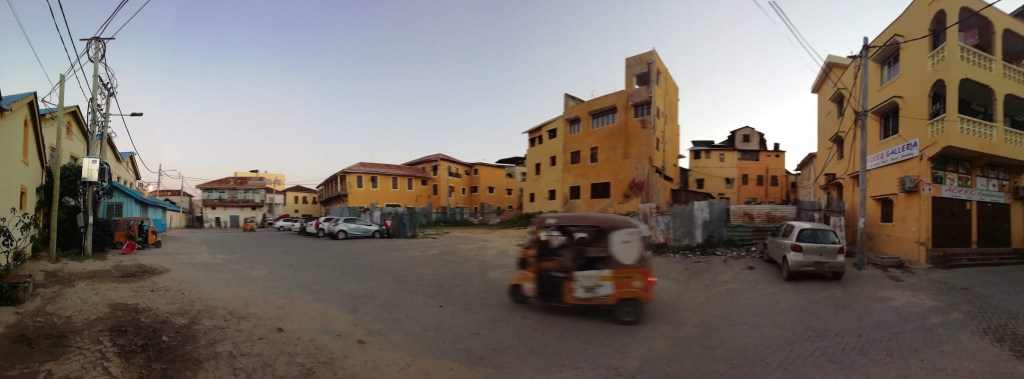
Mombasa’s chaos was pleasant and warm, nothing like the loud, overwhelming chaos of Nairobi. Tuk-tuk and moto-taxis were everywhere, painted in bright colours, with an Indian flavour to them. Mombasa’s old town was a beautiful place to explore. A local girl took me under her wing and guided me through the narrow alleys, the old buildings, with their wooden doors and balconies decorated with Arab motives. We entered a coffee shop, sat on the carpets and had a cup of coffee brewed with cinnamon and spices. My lips, cracked in the dry altitude of Mt Kenya, were starting to heal in Mombasa’s gentle climate, a gift of the Indian Ocean nearby.